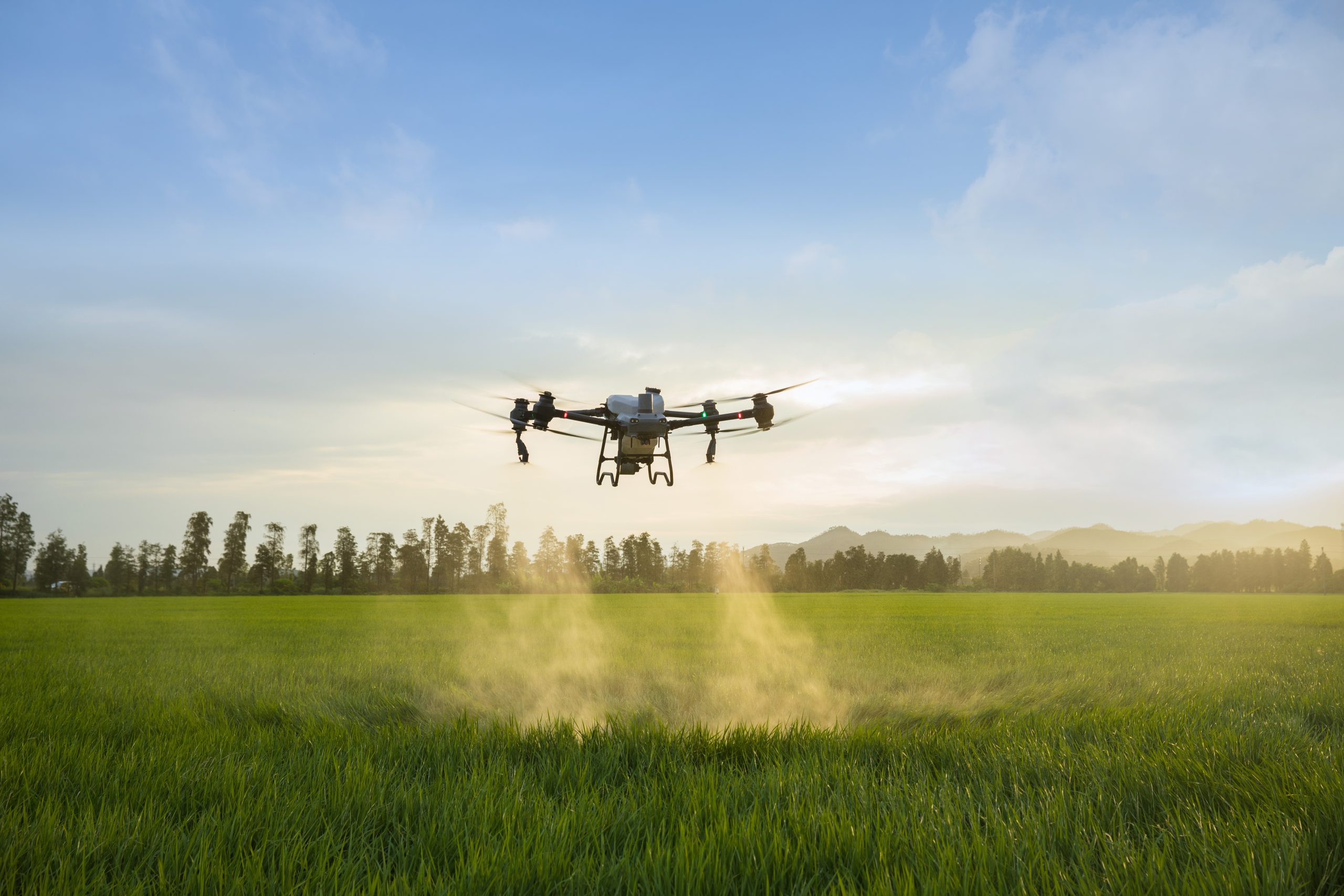
The DJI Agras T50 is a drone designed to optimize precision farming through advanced spraying and spreading capabilities. The T50 includes a high payload capacity of up to 50 kg for spreading and 40 kg for spraying, supported by a spiral spreader mechanism that ensures uniform distribution and minimizes clumping with a maximum flow rate of 24 litres per minute for spraying.
Key Features:
High Payload Capacity: The drone supports up to 50 kg for spreading and 40 kg for spraying, allowing for efficient handling of large quantities of fertilizers, seeds, and chemicals.
Dual Pump Spraying System: Featuring a magnetic drive impeller pump system, it provides a maximum flow rate of 24 L/min with adjustable droplet sizes ranging from 50-500 μm, enabling precise application based on crop requirements.
Spiral Spreader Mechanism: This mechanism ensures uniform material distribution and minimizes clumping, enhancing spread quality over large areas.
Advanced Navigation and Safety Systems: The drone utilizes active phased array radar and binocular vision sensors for obstacle detection and terrain following, maintaining consistent altitude and avoiding obstacles even on complex terrains with slopes up to 50 degrees.
Long Flight Time and Quick Charging: The T50 offers approximately 22 minutes of flight time per charge, with a battery charging time of 9-12 minutes using the DJI intelligent power supply.
Automated and Manual Operation: It supports fully automated flight planning and manual control options, providing flexibility for different field conditions and operator preferences. Automated options include route planning based on satellite maps, in-field GPS marking, and real-time obstacle marking.
Enhanced Signal Stability: The drone incorporates O3 transmission technology, providing stable communication over a 2 km range, even in environments without cellular service.
Integrated Aerial Surveying: The T50 is equipped with a high-resolution FPV camera and supports RTK positioning for accurate 3D flight route generation, enabling precise field mapping and crop health monitoring.